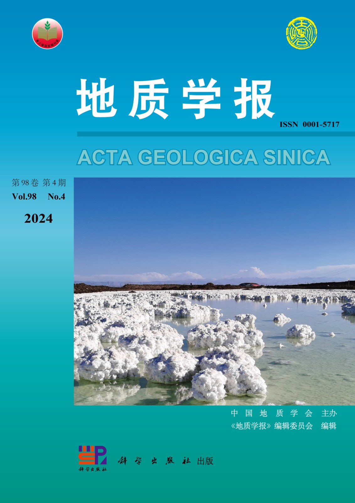
• Volume 94,Issue 4,2020 Table of Contents
    Select All
    Display Type: |
    • Contents

      2020, 94(4):0-0.

      Abstract (747) HTML (14) PDF 44.79 M (746) Comment (0) Favorites

      Abstract:

    • >Research Articles
    • High- energy oncoids within the ooid- grained bank built by photosynthetic biofilms: a case study of the Cambrian Zhangxia Formation at the Sandaogou section of Huludao City in the western part of Liaoning Province

      2020, 94(4):999-1016. DOI: 10.19762/j.cnki.dizhixuebao.2019129

      Abstract (1130) HTML (17) PDF 24.69 M (1150) Comment (0) Favorites

      Abstract:The oncoid is a variety of microbial carbonate with double attributes: (1) amongst the coated grains the oncoid is distinguished from the ooid by its relatively large size and non- smooth lamina within its cortex; (2) it is a variety of spherical stromatolite with an obvious biosedimentation structure resulting from successive lamination processes. High- energy and micrite- dominated oncoids are developed within a massive ooid- grained bank in the Zhangxia Formation of the Cambrian Miaolingian at the Sandaogou section of the Huludao City in the western part of Liaoning province. Following features characterize these oncoids: (i) centimeter level size; (ii) chiefly oval morphology; (iii) the characteristic laminated fabric within the cortex; (iv) the common and relatively high- density preservation of calcified- sheath fossils of the filamental cyanobacteria within the cortex. Although the greatest challenge that remains is the interpretation of ancient oncoids and the details of their formation through the filter of the diagenesis, even the processes involved in calcification of biofilms dominated by the cyanobacteria are not well understood. The rich evidence represented by microbial fossils, especially for sheath fossils of the cyanobacteria within oncoids, in the top part of Zhangxia Formations at the Sandaogou section provides a good example of oncoids built by photosynthetic biofilms. They also provide an opportunity to understand the differences between processes forming the ooid within the water column and the oncoid growing on the seafloor.

    • New forefin specimens and comparison of Early Triassic Ichthyopterygia from the Hubei Province

      2020, 94(4):1017-1026. DOI: 10.19762/j.cnki.dizhixuebao.2020028

      Abstract (1152) HTML (15) PDF 7.87 M (1323) Comment (0) Favorites

      Abstract:Chaohusaurus geishanensis, an Early Triassic ichthyopterygia found in China, shares similar forefin and skull structures and reveals a systematic relationship to Grippia in Europe. However,further intercomparison was difficult because specimens subsequently discovered in China were either highly specialized in forelimb or incomplete. Here, two nearly complete and non—specialized forelimbs of Chaohusaurus found in the Lower Triassic Jialingjiang Formation in Hubei Province are described with related information on basal ichthyopterygians in China. Morphological comparison reveals that the general features of the Early Triassic Chaohusaurus in the Hubei Province were close to Ch. geishanensis of the same genus, but distinctly different from Ch. chaoxianensis. Its features such as relatively large individual size, intermediate squeezing and deformation and pisiform development shares some similarities with Grippia,Utatsusaurus,Parvinatator and other Early Triassic ichthyopterygians. Based on these results we propose that there were possibly two directions for evolution of the Early Triassic ichthyopterygians. After the end- Permian mass extinction (EPME), ichthyopterygians appeared and soon differentiated during the Olenekian. Some large individuals without specialized forelimbs but with strong motor ability migrated between different regions. However, other small individuals with specialized forelimbs and weak motor ability became a local (eastern Tethys) independently evolving branch. However,the clarification of the phylogenetic relationship between them, and the monophyly of Chaohusaurus needs to be tested by future studies.

    • Mesoproterozoic stratigraphic attribution and tectonic evolution in the southern margin of the North China Craton: evidence from the detrital zircon U- Pb geochronology and zircon trace elements

      2020, 94(4):1027-1045. DOI: 10.19762/j.cnki.dizhixuebao.2020006

      Abstract (1359) HTML (16) PDF 12.67 M (1370) Comment (0) Favorites

      Abstract:The issue of age attribution of the Mesoproterozoic sedimentary strata, regional paleogeographic pattern, and tectonic evolution in the southern margin of the North China Plate has recently been the subject of vigorous debate. This study reports U- Pb geochronology and characteristics of trace elements in detrital zircons from the Yunmengshan Formation of the Ruyang Group, and the Huanglianduo Formation in the Lushan- Xiatang area of the western Henan Province. The weighted average age of the youngest batch of zircons from the Yunmengshan Formation is 1658±63 Ma which constraints the earliest sedimentary age of the Ruyang Group to no earlier than 1700 Ma. Combined with the chronological calibration of the Luoyukou Formation (1611~1638 Ma) of the upper part of the Luoyu Group, the formation age of the Ruyang and the Luoyu groups was limited to 1700~1600 Ma, which is the middle and late period of the Mesoproterozoic Changcheng period, corresponding to the international Statherian Period. The 207Pb/206Pb ages of the detrital zircons from the Yunmengshan and the Huanglianduo formations range from 1644 Ma to 3179 Ma, displaying six age peaks of 1850 Ma, 2100 Ma, 2300 Ma, 2500 Ma, 2670 Ma and 2900 Ma, corresponding to the Middle Archean- Palaeoproterozoic geological events of the North China Craton (NCC). The provenance of the Yunmengshan Formation is dominated by the 1850 Ma peak age geological body, and the Huanglianduo Formation by the 2500 Ma peak age geological body. According to the sedimentary properties and the formation background of the Yunmengshan Formation, the geochemical characteristics of the Xiong’er Group volcanic rocks and their corresponding zircons, the sedimentary characteristics of the Xiong’er Group sedimentary rocks and the basin’s tectonic attributes, would indicate that the Xiong’er Group and the overlying Ruyang Group were formed in the post- arc basin symbiotic with the “island arc”. Based on the “synsedimentary zircon” of the Yunmengshan Formation with the geochemical characteristics of the “island arc”, it is suggested that the island arc volcano was still active during the period of the Yunmengshan Formation.

    • Depositional age and provenance analysis of the Luanchuan Group in the southern margin of North China Craton and its significance for regional tectonic evolution:constraints from zircon U- Pb geochronology and Hf isotopes

      2020, 94(4):1046-1066. DOI: 10.19762/j.cnki.dizhixuebao.2019153

      Abstract (1428) HTML (15) PDF 14.05 M (1215) Comment (0) Favorites

      Abstract:There is a long- standing controversy about the depositional age and tectonic significance of the Luanchuan Group located between the tectonic units of the Qinling orogenic belt and the North China Craton (NCC). In this paper, the provenance and regional comparative analysis of Luanchuan Group from the perspective of zircon U- Pb chronology and Hf isotopes could provide important evidence of late Precambrian tectonic evolution in the southern margin of NCC. The crystallization age of epi- metamorphic trachyte from the Dahongkou Formation in the upper part of the Luanchuan Group is 854±8 Ma, and its petrogenesis is mainly due to the recycling of Late Paleoproterozoic continental crust. The depositional age of the Luanchuan Group is constrained between 917~844 Ma by the youngest clastic zircon U- Pb age of the metaclastic rocks of the Luanchuan Group and crystallization age of epi- metamorphic trachyte from the Dahongkou Formation and related intrusive rocks in the Luanchuan area, which belong to the Qingbaikou period. There are similar U- Pb ages and two- stage Hf model ages (TDM2) of detrital zircons amongst upper and middle parts of the Baishugou Formation, the Meijiaogou Formation and the Yuku Formation of the Luanchuan Group in the Luanchuan area. The U- Pb ages are mostly 1. 85 to 1. 10 Ga, which indicates that the North Qinling Terrane (NQT) was the most probable provenance, and TDM2 are between 1. 33~2. 92 Ga, which signifies that the provenance area has undergone 4 episodes of Proterozoic crustal accretion at ~1. 45 Ga, ~1. 8 Ga, ~2. 1 Ga and ~2. 5 Ga. The change in the provenance of Luanchuan Group from NCC to NQT and its sedimentary tectonic setting from passive continental margin to collisional orogeny and post- collisional extension environment during sedimentation of the Baishugou Formation are suggested by marked differences in the detrital zircon age spectrum between lower parts of the Baishugou Formation and other strata of the Luanchuan Group. A Meso- Neoproterozoic tectonic belt similar to the NQT, which essentially belongs to a part of the NCC, developed at least in the eastern and the southern margin of the NCC. The tectonic belt was strongly involved in the Columbia supercontinent breakup process and the Rodinia supercontinent convergence, and was briefly combined with the NCC during the early Neoproterozoic era to transform into main provenance for the peripheral sedimentary basin of the NCC.

    • The latest magma intrusion activities in the west Junggar: constraints from the Early Permian- Early Triassic Jietebutiao pluton

      2020, 94(4):1067-1090. DOI: 10.19762/j.cnki.dizhixuebao.2020001

      Abstract (913) HTML (15) PDF 26.51 M (1140) Comment (0) Favorites

      Abstract:The West Junggar area of the Central Asian Orogenic Belt, known for its complex tectonic movements, extensive magmatic activities and remarkable crustal growth, was formed in a critical period of ocean- continent transition in the Late Paleozoic. Jietebutiao pluton, located in the West Junggar area, Tianshan Orogenic Belt and Junggar Basin, is mainly composed of alkali feldspar granite, monzogranite and granodiorite in the southwest of West Junggar. The alkali feldspar granite, whose mineral composition consists of potassium feldspar (60%~65%), plagioclase (10%~15%), quartz (23%~25%) and few dark minerals, has no mafic microgranular enclaves. The monzonitic granite and granodiorite, whose mineral composition respectively consists of potassium feldspar (30%~40% and ~16%), plagioclase (30%~40% and ~50%), quartz (20%~25% and ~18%) and a small amount of dark minerals, has visible mafic microgranular enclaves. High- precision zircon U- Pb dating indicates that the Jietebutiao pluton was formed between 287~250 Ma pointing to multi- stage magmatic activity events during the Early Permian- Early Triassic. The Early- Triassic (2504 Ma) monzogranite is the youngest intrusive magmatic rock that has been found in the West Junggar so far and its intrusion means the end of Late Paleozoic magmatic intrusion activity. Jietebutiao plutons are characterized by high silica (SiO2=6704%~7701%), high- K calc- alkaline (K2O=345%~463%, Na2O=362%~418%, CaO=045%~0305%), low magnesium (MgO=016%~151%), low iron (FeOT=099%~440%), quasi aluminum- weak peraluminum (Al2O3=1260%~1501%). Trace elements of the Jietebutiao pluton have obvious right- leaning seagull type characteristics with distinct negative Eu anomalies in the chondrite- normalized Rare Earth Elements distribution pattern diagram, enriched in Light Rare Earth Elements and Rb, Th, K, depleted in Heavy Rare Earth Elements and Eu, Ba, Nb, Sr, P and Ti. The pluton shows characteristics similar to the I- type granite in terms of major and trace element, but there are also some differences between alkali feldspar granite and other granites. The alkali feldspar granite, characterized by low crystallization temperature compared with the A- type granite, belongs to the highly fractionated I- type granite. The monzonitic granite and granodiorite, characterized by high crystallization temperature, belong to the magmatic mixed I- type granite. Compared with the existing research results, we are convinced that the Jietebutiao pluton evolved during the stage of the intracontinental tectonic activity under the post- orogenic extensional environment with high temperature, low pressure and crustal thinning during the Early Permian- Early Triassic.

    • Sedimentary response of the Kuzigongsu Formation (J3k) to the Tethys Ocean closing in the Sarek basin

      2020, 94(4):1091-1105. DOI: 10.19762/j.cnki.dizhixuebao.2019175

      Abstract (740) HTML (15) PDF 8.66 M (882) Comment (0) Favorites

      Abstract:The closure time and subduction direction of the Bangong LakeNujiang Tethys Ocean have been a matter of considerable interest and debate. Previous studies have mostly focused on the formation age of the Bangong LakeNujiang suture zone. Despite the importance of studying the remote sedimentary response in the southwest Tianshan area caused by the subduction collision of the Bangong LakeNujiang Tethyan Ocean, very few reports exist on this topic. Orogenic activity in the southwest Tianshan region was caused by subduction collision of the Bangong LakeNujiang Tethys Ocean; the southwest Tianshan orogeny uplifted and denuded the mountain as was recorded by tuffite fission tracks, mountain denudation material that was transported and finally deposited in the piedmont basin or intermountain basin producing a sedimentary filling response within the basin. Hence, the sedimentary conglomerate reflects mountain erosion caused by orogenic movement which in turn reflects the subduction and collision of distant plates. Therefore, the study of sedimentary conglomerate in the basin is an indirect study of orogeny. The gravel statistical analysis,sedimentary facies analysis,high resolution sequence stratigraphic analysis of the Kuzigongsu Formation in the Sarek basin, in the southwest Iianshan mountains was undertaken. It is proved that the provenance of the Sarek basin is divided into two directions: NNE and West,and the alluvial fan deposits into two cycles. The results show that the remote response caused by the subduction collision of the Bangong LakeNujiang Tethyan Ocean in the late Jurassic can be divided into two stages. The first stage of tectonic activity is weak; the second stage of tectonic activity was intense, which resulted in the deposition of fine, medium, and coarse conglomerates. The alluvial fan conglomerates indicate that the Bangong LakeNujiang Tethyan Ocean was subducted northward at the end of the late Jurassic. The northward subduction collision the Bangong LakeNujiang Tethyan Ocean caused uplift and denudation of the southwest Tianshan mountain.

    • Sedimentary characteristics and depositional model of deep- water deposits dominated by gravity flow: A case study from the Lower Triassic in the Gonghe Basin

      2020, 94(4):1106-1127. DOI: 10.19762/j.cnki.dizhixuebao.2020009

      Abstract (1291) HTML (17) PDF 33.91 M (1113) Comment (0) Favorites

      Abstract:Deep- water deposits have good prospects for hydrocarbon exploration, and have become the frontier of sedimentology and the focus of hydrocarbon industry in recent years. Based on detailed observation and description of outcrops, combined with the microscopic identification and grain size analysis of rock slices, the sedimentary types, sedimentary characteristics, vertical sequences, genetic mechanism and depositional model of the Early Triassic deep- water deposits in the Gonghe Basin were systematically studied. The Early Triassic deep- water deposits in the Gonghe Basin are mainly slumping deep- water gravity flow deposits,bottomcurrent deposits and deep- water suspension deposits, among which the slumping deep- water gravity flow deposits can be identified as slump deposits, sandy debrites and turbidites. Slump deposits are often characterized by a variety of soft- sediment deformation structures(SSDS) represented by synsedimentary folds. Sandy debrites are dominated by massive sandstones, with occasional sandy masses, muddy gravel or muddy debris inside. Massive sandstones are in abrupt contact with both overlying and underlying strata. Turbiditesare generally developed with graded bedding, showing incomplete Bouma sequence, and various types of bottom cast structures are common on the subface. Bottom current deposits are characterized by multiple tractive current sedimentary structures.There are abundant types of SSDS in the study area, in which the SSDS in slump beds are mainly formed in the process of slope failure, the SSDS in non- slump beds are mainly formed by liquefaction and fluidization of sediments caused by earthquakes. On the basis of comprehensive analysis of basin tectonic setting, distribution of deep- water deposits and triggering mechanism of gravity flow, the depositional model of the Early Triassic deep- water deposits dominated by slumping gravity flow in the Gonghe Basin was established.Slumping gravity flow is mainly triggered by earthquakes and volcanic events, and a widely distributed submarine fan depositional system is formed in the channelized zone. As the driving force that can not be ignored in deep- water environment, the bottomcurrent often reworks the gravity flow deposits to make their reservoir quality better.As the background deposits, deep- water suspension deposits become the dominant deep- water deposits during the intermittence of gravity flow events.The study shows that the inner and middle fans are favorable exploration areas for tight sandstone oil and gas, while the outer fan has the prospect of shale oil and gas exploration.

    • Uranium micromineralogy and geochronology of the Jiangtou Uranium Ore Field in the Qingzhangshan granite pluton, north Guangdong: constraints on the genetic relationship with metallogenic dynamic background

      2020, 94(4):1128-1142. DOI: 10.19762/j.cnki.dizhixuebao.2019176

      Abstract (897) HTML (16) PDF 7.86 M (895) Comment (0) Favorites

      Abstract:Qingzhangshan (Longyuanba) pluton, located between the Zhuguang and the Guidong granitic complexes that are two of the most important granitetype uranium concentration areas in South China, is a poorly investigated area in the study of granitetype uranium deposits. Jiangtou uranium mining area is located in overlap region of the northern part of the Qingzhangshan pluton and the Nanxiong fault basin. Till date, the chronology of the uranium deposits remains unknown. The micromineralogical characteristics of uranium in this area have been studied by means of electron microprobe. At the same time, the UThPb chemical ages of magmatic crystalline uraninite and hydrothermal pitchblende have been calculated, and the dynamic background of uranium mineralization and oreformation has been discussed. Results show that the uranium minerals in the coarsegrained porphyritic biotite granite and mediumgrained porphyritic biotite granite are mainly uraninite and coffinite and some uraninite show obvious characteristics of uranium release. The chemical ages of uraninite are 246. 8±8. 8 Ma and 161. 5±8. 0 Ma which are consistent with the range of previous zircon UPb ages, representing the diagenetic ages of the Indosinian and the Yanshanian granites respectively. It shows that before the formation of Nanxiong fault basin, the Qingzhangshan pluton and the Zhuguang pluton were an organic whole with the same diagenetic and metallogenic environment. The uranium minerals in the ore of the Jiangtou mining area are mainly disseminated pitchblende accompanied by a small amount of brannerite, coffinite, etc. The chemical ages of pitchblende are 121. 3±9. 8 Ma, 98. 8±8. 0 Ma and 73. 2±8. 8 Ma, representing ages of three stages of uranium metallogenesis in this area. Combined with the six tectonic extensional movements since the Mesozoic, it had been considered that uranium mineralization in this area is controlled by dual factors: metallogenic dynamic background of deep fault depression activity in the margin of MesozoicCenozoic basins, and the distribution of uraniumproducing granite bodies. The Qingzhangshan pluton should have similar prospecting prospects as the Zhuguang and the Guidong plutons.

    • Petrogenesis of the Chashan granite in the northern Guangdong Province and its implication for the metallogenic potential of tungsten and uranium mineralization

      2020, 94(4):1143-1165. DOI: 10.19762/j.cnki.dizhixuebao.2020022

      Abstract (1121) HTML (13) PDF 9.18 M (837) Comment (0) Favorites

      Abstract:The southern Zhuguangshan complex pluton (SZCP) is one of the important uranium mineralization areas hosted in granitoid in China, and a few granites in SZCP show tungsten mineralization. The Chashan granite in the north central area of the SZCP has received less attention. The LA- ICP- MS zircon U- Pb dating yields an age of 142. 8±1. 9 Ma, suggesting that the Chashan granite was formed in the Early Yanshanian. Petrographically the Chashan granite commonly contains muscovite, and is characterized by enrichment of SiO2, mildly high alkalinity, and depletion of FeOT, MgO, CaO and P2O5. Geochemically it is also highly fractionated (DI=92. 2~95. 6) and peraluminous (ACNK=1. 00~1. 08). Most of samples display low total REE contents (∑REE=90. 5×10⁻⁶~163×10-6), negative Eu anomalies (δEu=0. 04~0. 08), enrichment of Rb, U and Ta, and depletion of Ba, Sr, Ti and P. Petrographical and geochemical features of these samples suggest a highly fractionated S- type granite. Isotopically, the Chashan granite has low and constant εNd(t) values (-10. 6~-9. 4) with two stage model age of 1. 70~1. 80 Ga. Integrated with the values of Rb/Sr (12. 6~77. 3) and CaO/Na2O (0. 10~0. 28), we suggest that the granitic magma of the Chashan granite, formed in the Early Yanshanian intraplate extensional environment, may have been derived from the partial melting of metapelite that originated from the ancient crust rocks separated from the mantle in the Paleoproterozoic. An intercomparison shows that the Chashan granite shows similar geochemical properties as the Indosinian uranium- bearing granites and the Yanshanian tungsten- bearing granites in South China, but has extremely low tungsten concentration (1.60×10⁻⁶~3.94×10⁻⁶), indicating a relatively low tungsten metallogenic potential. These samples exhibit high uranium content (averaging 19×10-6) and common presence of uranium in some U- rich accessory minerals (such as uranothorite) which are prone to be leached. In addition, the faults were well and extensively developed in this area, resulting in the granite being intruded by late stage granitic dykes and experiencing significant hydrothermal alteration. Uranium mineralization found in the northwest part of the Chashan granite and pitchblende was discovered by drilling zk55- 4. In conclusion, the Chashan granite shows a greater uranium than tungsten metallogenic potential.

    • The discovery and genesis of the manganeserich rocks in the southern Beishan Mountain, China

      2020, 94(4):1166-1182. DOI: 10.19762/j.cnki.dizhixuebao.2020015

      Abstract (909) HTML (15) PDF 16.27 M (977) Comment (0) Favorites

      Abstract:A survey was conducted in the southern Beishan Mountain to ascertain mineral ypes and distribution. A manganeserich rock bed, 0. 5 m thick at the surface, extending 4. 6 m in the horizontal direction with a bean shape has been discovered in the quartz schist in Changchengian System stratum. Its upper part is Mnlimestone and Mnmagnetite quartz rock, sandwiched between Quartz schist. The manganese ore is black, bulky, semimetallic luster, and also occurs as dirty bands. The results of the manganeserich rock samples by quantitative chemical analysis are Mn 29. 68%, 30. 59%, 27. 72%,Mn/Fe 9. 2, 9. 8, 8. 7,P/Mn is 0. 00071, 0. 00078, 0. 00076. The Mn content of Mnlimestone is 4. 62~4. 92% and of Mnmagnetite quartz rock is 0. 52~1. 54%. Moreover, based on the phase analysis tests, the Xray diffraction the electron probe data, and the microscopic identification, the important minerals are Rhodochrosite (MnCO3), Pyrolusite (MnO2), Manganite(MnO2·Mn(OH)2),Spessartine (Mn3Al2(SiO4)3), Johannsenite (CaMn(SiO3)2), Rhodonite ((Mn,Fe,Ca)5Si5O 15 ), Tephroite ((Mn2SiO4)), and some other minerals, have been determined. A global comparison of the characteristics and mineral assemblages of this ore shows strong similarities with the Paleoproterozoic Serra do Navio manganese deposits in Brazil, the Devonian metamorphosed manganese deposits of the South Urals, and the Cretaceous NodaTamagawa Mine in Japan. Based on fieldwork, Mn content and the special mineral assemblages we propose that: (i) the manganeserich rock was possibly deposited in the shallowmarine and marine environment around the Dunhuang ancient block edge areas. The manganese was derived from the continent and the hydrothermal fluid sources. (ii) Subsequently, in a period of regional metamorphism and contact metamorphism, sandstone had metamorphosed into quartz schist, the ores of Rhodochrosite and Pyrolusite and Manganite, as the primary high quality manganese ores, had become into Mnsilicate. (iii) After prolonged supergene weathering, the manganeserich rock presently seen were formed. (iv) The discovery of manganeserich rock indicates that there is a metallogenic geological environment for the formation of manganese deposits in this area.

    • Spatial variability in the geochemical characteristics of the K- rich brines in the Lop Nor

      2020, 94(4):1183-1191. DOI: 10.19762/j.cnki.dizhixuebao.2020007

      Abstract (876) HTML (12) PDF 7.83 M (768) Comment (0) Favorites

      Abstract:Lop Nor, containing abundant potassiumrich brine, is one of the most important saltforming basin in China. Past 14 years of industrial mining show changing geochemical characteristics of brines in different ore layers. In order to estimate the spatial geochemical distribution of potassiumrich brines in different mining areas and utilize brine water resources, we have used the Kriging interpolation method to analyse the spatial distribution of 89 brine samples collected in 2017, and drawn the contour maps of K+, Cl-, Na+, Mg2+, Li+, B3+, SO42-. The results show that K+, Cl-, Mg2+, Li+, B3+ have a relatively consistent distribution trend. The high value area is mainly located in the Luobei depression and the northern part of the Tenglong platform, and the low value areas are located in the north of the Luobei depression and southwest of the mining area. However, the SO42- distribution trend is reversed. Due to the influence of freshwater 〖JP〗supply from the surrounding areas, desalination occurs in the southwest, north and southeast of the mining area; however, only W1 and W2 layers were affected, and the W3 layer shows no obvious desalination. The average K+ content of Lop Nor is 8. 83g/L. Except for the area affected by fresh water, the KCl grade in most areas was higher than the industrial separate mining grade of 1%. Compared with KCl grade before mining, the average grade of KCl in W1 layer of Luobei depression is about 9. 7%.

    • Sandstone geochemical constraints on the provenance and tectonic setting of the Banjiuguan Formation in the North Daba Mountain

      2020, 94(4):1192-1207. DOI: 10.19762/j.cnki.dizhixuebao.2020014

      Abstract (940) HTML (32) PDF 9.36 M (1033) Comment (0) Favorites

      Abstract:The North Dabashan Mountain, an important part of the South Qinling orogenic belt, holds well preserved sedimentary records. For a long time, the Banjiuguan Formation was considered to have formed in a relatively stable tectonic setting. In this paper, sedimentary successions and geochemical analyses are used to determine its provenance and tectonic setting. The Banjiuguan Formation consists of finegrained sandstones, siltstones and mudstones deposited in deep waters. Facies assemblages indicate that they were deposited in a submarine fan environment. Paleocurrent data preserved in cross bedding indicates that sediments were proximally derived from north. Chemical classification of the Banjiuguan sandstones shows that the analyzed sediments are mostly litharenite. The REE patterns are characterized by LREE enrichment, flat HREE, and negative Eu anomalies. Chemical Index of Alteration range from 51 to 67, and Th/U ratio is 3. 36 to 7. 02, both of which suggest weak weathering. The rations of Zr/Sc and Th/Sc further show that the sandstone experienced no reworking. Various plots and parameters for sedimentary provenance show that the sediments were sourced predominantly from felsic rocks. Geochemical data suggest that they were deposited in an environment related to continental island arc setting and passive continental margin.

    • Paleontology, geochemistry and provenance of sedimentary rocks from the Triassic Langjiexue Group in the Yarlung Zangbo suture zone, Tibet and their tectonic setting

      2020, 94(4):1208-1226. DOI: 10.19762/j.cnki.dizhixuebao.2020008

      Abstract (815) HTML (13) PDF 5.91 M (1028) Comment (0) Favorites

      Abstract:With the decomposition of the Langjiexue Group in recent years, it has been found that the previous studies on the Langjiexue Group, Nieru Group, Xiukang Group and Luolin Group are confused. The study of Langjiexue Group should be reconsidered. Moreover, it is controversial whether the above strata were formed in the same tectonic environments. In this paper, we study the heavy mineral characteristics, geochemical characteristics and paleontological fossils of the Langjiexue Group in the Jiedexiu Town, Langjiexue country, Gongga County, China. The chemical composition of major and trace elements in the Langjiexue Group are lower than the Clarke value of the crust. The average content of SiO2 is 74. 14%, and the average value of K2O/Na2O is 0. 70. The above characteristics indicate that the maturity of sandstone is low, and it has not undergone obvious epigenetic reworking. The chemical alteration index (CIA) is relatively concentrated, averaging 71. 55, which belongs to low- medium weathering degree, indicating that the climate and tectonic environment were in a relatively stable state. The average values of 100Mg/Al2O3 and CaO/Fe+CaO are 7. 85 and 0. 314 respectively, indicating that the Langjiexue Group formed in a deep- water anaerobic environment with moderate salinity and gradually deepened from north to south. Heavy minerals are mainly poorly separated zircon and rutile. ATi index is 93. 3~98. 97, ZTR index is 48. 01~85. 75, reflecting that volcanic rocks in the source area of the Langjiexue Group were abundant, and their transportation distance was relatively short. REE- La/Yb diagrams, Hf- La/Th diagrams, F1- F2 diagrams, Th/Sc- Zr/Sc diagrams and heavy mineral characteristics show that the source area of Longjiexue Group comprises intermediate- acid igneous rocks and continental margin clastic rocks. Based on the evidence of paleocurrent direction, the evolution of the Zhikong- Songdo Tethys Ocean, the Middle- Late Triassic magmatic rocks in South Gangdise, and the peak age (240 Ma) of clastic zircons from the Langjiexue Group, the provenance of the Langjiexue Group is South Gangdise. Tectonic discriminant diagrams show that the Langjiexue Group is a product of a specific tectonic setting between the continental island arc and the active continental margin environment, and the formation environment is closer to the active continental margin side. Paleontological fossils, represented by Halobia convexa, indicate that the Langjiexue Group was formed during the Carnian- Norian period of the Late Triassic. Based on the analysis of weathering degree, provenance area, tectonic background and formation age, the formation of the Langjiexue Group coincides with the evolution of the Yarlung Zangbo Tethys Ocean.

    • Identification and petrogenesis of a highly differentiated A- type granite formed in the late Mesozoic, central Jiangxi Province

      2020, 94(4):1227-1247. DOI: 10.19762/j.cnki.dizhixuebao.2020105

      Abstract (750) HTML (16) PDF 10.00 M (900) Comment (0) Favorites

      Abstract:Strong magmatic differentiation by fractional crystallization could significantly modify the apparent geochemical features of A- type granites, resulting in an ambiguous boundary between A- type and I/S- type granites. Thus, distinguishing between these types of highly differentiated granites presents a significant challenge. The Dawushan granitic intrusive body in the central Jiangxi Province could be an illustrative case to demonstrate methods for discriminating a highly differentiated A- type granite. The Dawushan granite, composed of medium- grained biotite monzogranite (phase I) and fine- grained muscovite- bearing biotite alkali feldspar granite (phase II), is located in center of the Cathaysia Block and the northern Nanling Range. Zircon U- Pb dating shows that the formation ages of phase- I and - II are 156 Ma and 155~157 Ma respectively. The Dawushan granite is characterized by low P2O5 (0. 05%~0. 16%), high SiO2 (70. 8%~74. 9%) contents, high Rb/Sr (averaging 9. 05) and Rb/Ba ratios (averaging 2. 38), and is weakly to strongly peraluminous. Plots in the triangular diagram of Rb- Ba- Sr and bivariate diagram of Th/Nd- Th suggest that the Dawushan granite experienced a high degree of differentiation. Other characteristics, 〖JP2〗such as high Ga/Al ratio (2. 89~3. 48), zircon saturation temperature (839 ℃), and anhydrous feature indicated by interstitial biotite aggregation suggest that it is an A- type granitic intrusion. Considering strong fractional crystallization of minerals enriched in zirconium, such as zircon and sphene, the Dawushan granite shows a linear trend distinctively different from the I/S- type granite on the diagrams of 10000×Ga/Al vs. Zr+Nb+Ce+Y and Zr vs. SiO2. In addition, its Y/Nb ratios are greater than 1. 2. Taken together, these characteristics suggest that the Dawushan granite belongs to a highly differentiated A2 granite rather than a differentiated I- or S- type granite. Therefore, on the basis of petrology, mineralogy and geochemistry analyses, the distinctive evolving trends shown on the diagrams of 10000×Ga/Al vs. Zr+Nb+Ce+Y and Zr vs. SiO2 by the I- & S- type and the A- type granites can be effectively used for identifying and discriminating between different primary rock types of highly fractionated granites. Isotopically, the Dawushan granite exhibits low εNd(t) (-9. 23~-14. 6) and εHf(t) values (-10. 2~-6. 5), and old two- stage Nd model ages of 1. 7~2. 0 Ga. Considering with the metamorphic rocks outcropped in this region, the Dawushan granite could have originated from a composite source consisting of orthometamorphic and parametamorphic rocks similar to the Zhoutan Group. In particular, such a source experienced an S- type melting extraction event during the Indosinian Period, leaving behind relatively refractory materials similar to diorite in composition. In the Yanshanian Period, the second melting event occurred in the residual source at higher temperatures with heat from the upwelling hot asthenospheric mantle under regional extension leading to the formation of the Dawushan A- type granite.

    • Petrology,geochemistry and zircon U- Pb geochronology of the Chaidamushan granite from the southern margin of Qilianshan

      2020, 94(4):1248-1263. DOI: 10.19762/j.cnki.dizhixuebao.2020053

      Abstract (1317) HTML (13) PDF 3.08 M (903) Comment (0) Favorites

      Abstract:The Chaidamushan granite rock mass,in the Dachaidan Town,Qinghai Province,is mainly composed of porphyritic monzonitic granite,granite porphyry and rapakivi granite. Representative rocks were selected for main and trace element study and LA- ICP- MS zircon U- Pb geochronology to explain the magma genesis,tectonic setting and their significance. The results show that in the Chaidamushan granite the K2O/Na2O ratio changed from 1. 11 to 4. 41,the Litman index ranged between 1. 31 to 2. 20,A/CNK between 1. 06 and 1. 66,indicating a high potassium calc- alkaline, peraluminous and highly fractionated I- type granite. In the primitive mantle- normalized trace element distribution pattern,they show different degrees of enrichment of large ion lithophile elements (LILE) Cs,Pb,K,etc. and light rare earth elements (LREE),relative loss of high field strength elements (HFSE) Y, Yb,has obvious negative anomalies of Ba, Nb, Ta, Sr, P and Ti. The total amount of rare earth elements is 207. 94×10-6~418. 40×10-6,the ratio of LREE/HREE is 5. 67~10. 29,the ratio of (La/Yb)N is 5. 88~13. 84,δEu is 0. 09~0. 50,δCe is 0. 99~1. 36,Sr/Y is 0. 87~3. 47,Rb/Sr is 1. 22~15. 45,K/Rb is 0. 01~0. 02,and Nb/Ta is 0. 63~11. 88. Rare earth element chondrite- normalized distribution pattern is characterized by the relative enrichment of light rare earths,the right- dip type of heavy rare earth relative loss,and negative Eu anomaly. Four samples were selected for LA- ICP- MS zircon U- Pb dating; the results showed that the granite porphyry in D3755- 1 206Pb/238U age ranged from 400 Ma to 407 Ma,and the weighted average age was 404. 6±2. 9 Ma (MSWD=0. 094);in PM11- 1 206Pb/ 238U age ranged from 413 Ma to 424 Ma,with a weighted mean age of 418. 4±3. 0 Ma (MSWD=0. 30);in monzonitic granite D1028- 1 206Pb/238U age ranged from 426 Ma to 436 Ma,with a weighted mean age of 434. 3±2. 0 Ma (MSWD=0. 21);in granodiorite D1506- 1 206Pb/238U age ranged from 434 Ma to 439 Ma,with a weighted mean age of 437. 2±2. 6 Ma (MSWD=0. 076),suggesting that the crystallization age of the Chaidamushan granite is between 437. 2 Ma to 404. 6 Ma i. e. from the Early Silurian to the Early Devonian. The magmatism in the southern margin of the Qilianshan- North Chaidam lasted for a long time (372~473 Ma),with multiple stages dated to 450~470 Ma,430~450 Ma,410~430 Ma,400~410 Ma,370~400 Ma,amongst which 430~450 Ma and 400~410 Ma represent the two main peak periods of granite intrusion closely related to the high- pressure or ultra- high pressure metamorphism. The early period (430~470 Ma) is a response to the northward subduction of the south- Qilian ocean plate beneath the Qilian block; as the Qaidam block continued to subduct,the Qilian block from the north to the south thrusted over the Qaidam block to form a series of continuous magmatic intrusion activities in continent- continent collision zones. The late period (370~430 Ma) is a response to the deep subduction plate after the Qaidam block and the Qilian plate collided, were dismantled, and re- entered a series of magmatic intrusion activities in the stretching and sliding between different blocks. Spatial distribution of the Saishitengshan and the Aolaoshan in the northern margin of Chaidam represents the early magmatic activity,mainly I- type granite. The Luliangshan- Dachaidan- Xitieshan- Dulan area represents the late magmatic activity and has the characteristics of I- and S- type granites. The Chaidamushan rock mass represents the multi- stage magmatic activity in the southern margin of the Qilian,and is simultaneous with the magmatic activity of the northern margin of the Qaidam Basin.

    • Chronology, types and genesis of post- collisional copper bearing magmatic rocks in the Xiongmei area, the middle part of the Bangong Co- Nujiang metallogenic belt

      2020, 94(4):1264-1281. DOI: 10.19762/j.cnki.dizhixuebao.2019178

      Abstract (766) HTML (12) PDF 16.82 M (912) Comment (0) Favorites

      Abstract:The Xiongmei area is located in the Shenzha County in the middle part of the Bangong Co- Nujiang metallogenic belt in Tibet comprising many different types of copper- bearing magmatic rocks. These include Shesuo skarn copper polymetallic deposits, Xiongmei porphyry copper- molybdenum deposits, Sangri karn copper deposits and Kuga skarn copper deposits. In this paper, the chronology and genetic types of these copper- bearing magmatic rocks have been determined by systematic zircon U- Pb age determinations, whole- rock Pb isotope, and petrogeochemical analysis. Preliminary data indicates that they were formed in successive magmatic stages dated to ~110 Ma (Shesuo, Xiongmei, Kuga) and 80 Ma (Sangri). The ore- bearing granodiorite porphyry in the Xiongmei mining area is an S- type granite formed from argillaceous sedimentary rocks with high aluminium and calc- alkaline characteristics. The ore- bearing rocks in the Shesuo, Sangri and Kuga mining areas are I- type, indicating that the original rocks were igneous. Geochemical analyses shows that these ore- bearing rocks are rich in large ion lithophile elements (Rb, Sr, Th, Pb) and depleted in high field strength elements (Nb, Ta, Ti), indicating that the subducted sediment components have had an important influence on magma formation. During the early Cretaceous, the subducted plate fragments broke off, a large number of asthenospheric material upwelled and participated in magmatic activities. This triggered the melting of upper crustal components and formed ore- bearing magmatic rocks with a large number of ore- forming elements, forming Xiongmei, Shesuo and Sangri deposits near the surface. During the late Cretaceous, the thickened lithosphere was dismantled and subsided under the action of gravity. The thin lithosphere melted under the underthrust of the upwelling mantle, forming the Sangri deposits.

    • U- Pb dating of zircon, Hf isotope composition and tectonic significance of the albite- leptite of the Lancang Group in the Shuangjiang area of western Yunnan,China

      2020, 94(4):1282-1294. DOI: 10.19762/j.cnki.dizhixuebao.2020038

      Abstract (1293) HTML (16) PDF 7.63 M (866) Comment (0) Favorites

      Abstract:The Lancang group, an important part of the Tethys orogenic belt, is located in the Changning- Menglian combined belt in the Sanjiang area of western Yunnan, China. In this paper, we have conducted zircon U- Pb dating, Hf isotope analyses and petrogeochemistry of albite- leptite to determine the genesis, chronology, and geotectonic evolution of the rocks in the Shuangjiang area. The detrital zircons with strongly oscillatory zoning employed for dating are of magmatic origin from albite- leptite. The U- Pb date, weighted average of 206Pb/238U, is 476. 5±1. 6 Ma, which is Early Ordovician (O1). The εHf(t) from the in- situ analysis of Hf isotopes is -5. 6~-2. 2 and the TDMc Age is 1591~1802 Ma indicating that the materials in the source area were formed by partial melting of ancient crustal materials from the terminal Early- Proterozoic to the early Middle- Proterozoic. According to petrogeochemical analysis, the original rock of albite- leptite is granitic diorite which is a peraluminous S- type granite with high SiO2=67. 89%~68. 91%, aluminum- rich Al2O3=14. 48%~15. 14% and high potassium calc- alkaline. The characteristics i. e. enrichment in LREE, the overall tilt to “right”, δEu(0. 60~0. 64)and strong negative Eu, indicated that plagioclase has separated from the magma. The analysis shows that the original rock of albite- leptite is island- arc granite, which formed in the continent- arc collision stage around Changning- Menglian Tethys, has the same tectonic background as the volcanic rocks of the Huimin Formation in the Ordovician. As Tethys entered intracontinental subduction- grinding stage, the island- arc granite is a subduction accretionary complex, between the Changning- Menglian combined belts and the Lincang Batholith, forming tectonic sheet of the Lancang group.

    • >Technical Method
    • Paleoearthquake events and inhomogeneous activity characteristics in the Benge- Cunge section of the Litang fault zone in the western Sichuan Province

      2020, 94(4):1295-1303. DOI: 10.19762/j.cnki.dizhixuebao.2020025

      Abstract (748) HTML (13) PDF 11.07 M (742) Comment (0) Favorites

      Abstract:Two trenches LT1301 and SLT1204 were excavated in the Benge- Cunge section of the Litang left- lateral strike- slip active fault zone in the southeastern margin of the Qinghai- Tibet Plateau. Based on the detailed description of the paleoearthquake events revealed in the two trenches, 10 OSL and 13 14C dates, the ages of paleoearthquake events in the northern part of the Litang fault zone were determined. The results show that the at least four paleoearthquake events are recorded in these two trenches. Among them, the small- scale trench LT1301 only reveals one paleoearthquake, which may either be a historical earthquake in 1729 A. D. or a major earthquake between 950 a and 1. 0 ka, a distinction currently being not possible due to insufficient chronological data from key locations. The larger trench SLT1204 reveals four paleoearthquakes including the one in the trench LT1301. The oldest paleoearthquake event I occurred before 9. 9 ka. Events II, III and IV occurred between 1729 and 4. 8 ka BP with a recurrence interval of 1. 6 ka. The paleoearthquakes in the northern part of the Litang fault zone in the Western Sichuan indicate that the recurrence of large earthquakes in the fault has non- linear characteristics and does not conform to the characteristic earthquake model. The frequency of large earthquakes in the late Holocene increased significantly, indicating that the fault is in the stage of cluster activity.

    • Sediment formation in Quyuan Town in the Three Gorges Valley and its implications for the geo- environment division

      2020, 94(4):1304-1314. DOI: 10.19762/j.cnki.dizhixuebao.2019147

      Abstract (745) HTML (13) PDF 8.65 M (785) Comment (0) Favorites

      Abstract:Investigation of Quaternary sediment source and deposition in the Three Gorges area is of critical importance in the study of geological disasters, disaster events, soil erosion and climate change. A ca. 5m thick sediment sequence from the Shidaling section, deposited near eastern Xintan landslide downstream of the Bingshubaojian Gorges, was recently discovered during a geological survey. In this paper, based on the field investigations, profile measurements, combined with systematic grain size analysis, the sediment source and depositional process of the Shidaling section were studied. The results show that: 1) upper sediment of the Shidaling section is mainly composed of size fraction of < 50μm, average content of size fraction of >50μm is 1314% while that of size fraction of between 10 and 50μm is 50%, which is the grain size fraction for the aeolian sediments; 2) grain size parameters, frequency curves and grain size distribution results (C- M, L- M and A- M figures) indicate that the upper Shidaling section is an aeolian deposit while the middle and lower Shidaling sections showing a typical positive dual- texture are fluvial deposits. Chronology and comparison with dating results of terrace reveal that the Shidaling section was formed between late middle- Pleistocene and late Pleistocene, the upper section formed at 110~60 ka BP. After correlation with the contemporaneously deposited sediments from the Yangtze River Basin, we propose that the upper Shidaling section is Xiashu Loess, and represents its western boundary. These results demonstrate that the Bingshubaojian Gorges is a division of the Xiashu loess and Wushan loess, which is similar to the loess in Chinese Loess Plateau. Geomorphologically speaking, the Bingshubaojian Gorges is a crucial area for studying regional climate and geo- environment and should receive more attention in future.

    • Application of comprehensive geophysical- drilling exploration to detect the buried Shunyi active fault belt in Beijing

      2020, 94(4):1315-1329. DOI: 10.19762/j.cnki.dizhixuebao.2020002

      Abstract (2595) HTML (14) PDF 19.54 M (1131) Comment (0) Favorites

      Abstract:Shunyi fault is one of important buried faults in the Beijing plain. The Quaternary activity and ground deformation of this fault are important for optimizing the pattern of land space development, and constructing disaster prevention and mitigation plans in Beijing. Since the buried active fault is complex, we used controlled source audio- frequency magnetotelluric (CSAMT), shallow seismic reflection, high density resistivity and drilling exploration to detect its location, character and activity intensity. The results show that the Shunyi fault trends NE, dips to the SE, and is a normal fault. The Shunyi fault is an active fault with variable activity: its vertical activity rate was 0. 23 mm/a since the Early Pleistocene, 0. 03 mm/a since the Mid- Pleistocene, 0. 29 mm/a since the Late Pleistocene, and 0. 51 mm/a since the Holocene in the Beixiaoying town. There were spatial and temporal disparities in the Shunyi fault activity since the Quaternary. It was strongly active in the Early Pleistocene but showed weaker activity during the Middle Pleistocene. In the Late Pleistocene, the activity of Shunyi fault was enhanced, and the strongest activity occurred in the Holocene. It’s worth noting that the south segment of Shunyi fault had stronger activity than north segment since the Quaternary, and is still active, which may explain why the ground fissures appeared in Shunyi recently. Obviously, active faults control ground fissures in Shunyi area.

Established in 1922, Monthly

Editor in Chief :YANG Jingsui

Governing body:China Association for Science and Technology

Organizer:Geological Society of China

ISSN:1000-9515

CN: 11-2001/P

Domestic postal code:2-113

Foreign issue code:M 78

  • Most Read
  • Most Cited
  • Most Downloaded
Press search
Search term
From To